|
U.S. VFR Wall Planning Chart
This site does not host any Charts, all this site does do is foward you to the correct NACO server location in an easy to navigate user interface. From there you will be able to download the most current information. USE at your own RISK.
Some files are in a Zip file compressed to save space on the server it is hosted on, Click here to Download a Zip file reader. You can also download a PDF reader from the same link.
CHECK FOR UPDATES HERE!!
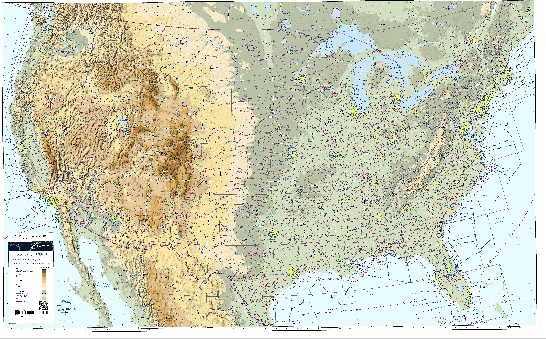
The U.S. VFR Wall Planning Chart is designed for VFR preflight planning and provides aeronautical and topographic information of the conterminous U.S. The aeronautical information includes airports, radio aids to navigation, Class B airspace and special use airspace. The topographic information includes city tint, populated places, principal roads, drainage patterns and shaded relief.
U.S. VFR Wall Planning Chart
| Version |
Current Edition No. and Date |
Next Edition No. and Date |
| Geo-referenced |
4 - Feb 06 2014 (ZIP) |
5 - Dec 10 2015 |
| Non Geo-referenced (PDF) |
4 - Feb 06 2014 (PDF) |
5 - Dec 10 2015 |
|